CLIMBING MANDALAY HILL WITH A MAP OF MIYAGI
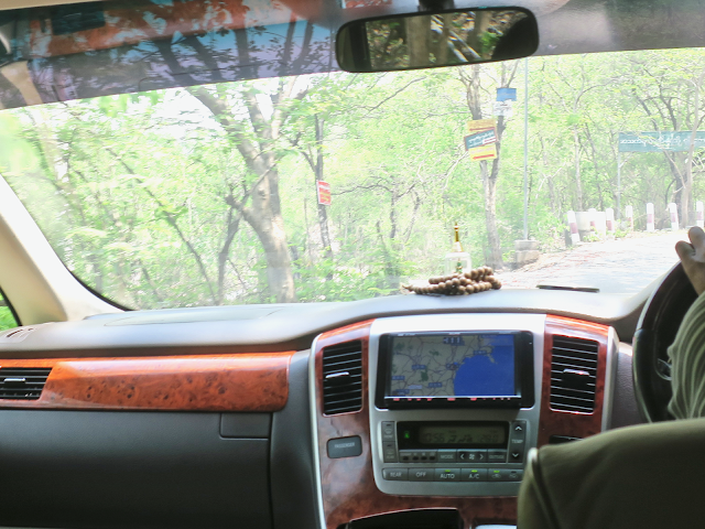
Climbing up Manadalay Hill, a main feature of Mandalay which has the Sutaungpyei Pagoda at its top. The hill is a major pilgrimage site for Burmese Buddhists and you can choose to walk up 1700+ steps to reach the pagoda. However, I chartered a taxi due to extremely hot and humid weather. The van I got was apparently a secondhand car brought from Japan and still had a Japanese navigation system whose screen was showing a map of Miyagi Prefecture for some reason. The shape of Oshika Peninsula that is familiar to me was clearly visible.
This hill is a temple, so again, I needed to take off my shoes and socks. And again, I took an escalator in bare feet.
この丘は寺院。そのため再び靴と靴下を脱がなくてはならない。そして再び裸足でエスカレーターに乗った。
Gold and shocking pink. A universe of mosaics.
ゴールドとショッキングピンク。モザイクの宇宙。
A panoramic view from Pagoda's terrace. Looking towards the west.
パゴダのテラスからのパノラマ。西の方角。
頂上にスータウンピー・パゴダを頂いたマンダレーのメインアトラクション、マンダレーヒルに登る。この丘はミャンマーの仏教徒にとって重要な巡礼地で、1700段超の階段を徒歩で登っていくことができる。しかし、暑さと湿気が猛烈だったのでタクシーをチャーターすることにした。やってきたバンは明らかに日本から持ってきた中古車で、残されたカーナビの画面はなぜか宮城県の地図を映し続けていた。見慣れた牡鹿半島の形がくっきり。
This hill is a temple, so again, I needed to take off my shoes and socks. And again, I took an escalator in bare feet.
この丘は寺院。そのため再び靴と靴下を脱がなくてはならない。そして再び裸足でエスカレーターに乗った。
Gold and shocking pink. A universe of mosaics.
ゴールドとショッキングピンク。モザイクの宇宙。
A panoramic view from Pagoda's terrace. Looking towards the west.
パゴダのテラスからのパノラマ。西の方角。


Comments